What’s new?
Updated proposals based on your input
This development will build on this foundation, delivering new homes and community benefits whilst responding directly to lessons learned from earlier applications.
Our approach is landscape led, with fewer homes than previously proposed, increased planting and green buffers, and a focus on delivering community benefits.
Key features
Key features for the new and existing community
- A reduced and rebalanced number of homes compared with previous applications, helping address housing need while responding to landscape concerns.
- A mix of housing types, including affordable homes (at a policy compliant 40%), supporting local families, key workers, young people and older residents looking to downsize.
- New community building, shaped in collaboration with local people to ensure it meets genuine needs.
- Landscape-led design with new planting, green buffers and habitat creation to integrate the development into its surroundings and enhance biodiversity.
- Improved walking, cycling and bus connections, making it easier to travel sustainably between Sulis Down, Odd Down and Bath city centre.
- Planning contributions towards infrastructure, ensuring local services keep pace with growth.
- Respect for Bath’s World Heritage setting, with careful design and heritage input to minimise impact on views and protect local character.

The site
Site location and wider context
Sulis Down lies to the south of Bath and Odd Down, to the west of South Stoke village. The land sits within the Cotswolds National Landscape and forms part of the setting of the Bath World Heritage Site, meaning landscape and heritage are of central importance.
The site was removed from the Green Belt and allocated in Bath and North East Somerset’s Local Plan over a decade ago for around 300 homes and associated uses. Phase one was approved in 2018. It delivered 171 homes on Combe Hay Lane behind Odd Down Park & Ride and is now home to a thriving new community of more than 300 people.

Masterplan overview
Key features of the emerging proposals:
- Around 200 new homes, including 40% affordable housing.
- A new community space located at the heart of the neighbourhood.
- Lower building heights, with a maximum of 2–2.5 storeys, to reduce visibility in long-distance views.
- Improved walking and cycling routes connecting the site to Odd Down, local schools and the wider area.
- A north–south green corridor linking into the surrounding landscape.
- A layout designed to maintain separation from South Stoke and protect key views.
- More than 5 hectares of green infrastructure, including strengthened woodland belts, new habitats and enhanced biodiversity.
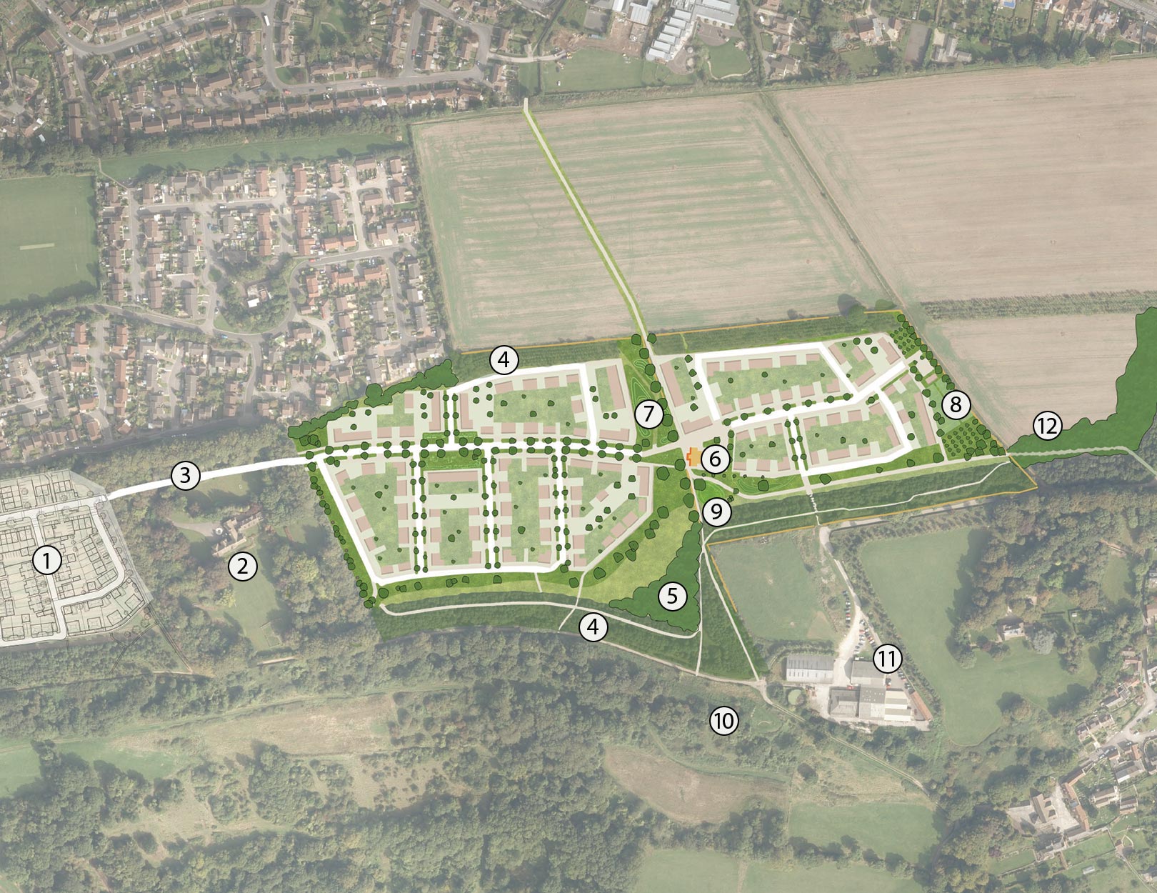
- 1Phase 1
- 2Sulis Manor
- 3Spine road
- 4Existing tree belts
- 5New tree planting
- 6Community building
- 7Public green space
- 8Allotments and orchards
- 9Play area
- 10Millenium view point
- 11Sulis Down business village
- 12Pedestrian/cycle link to South Stoke Lane
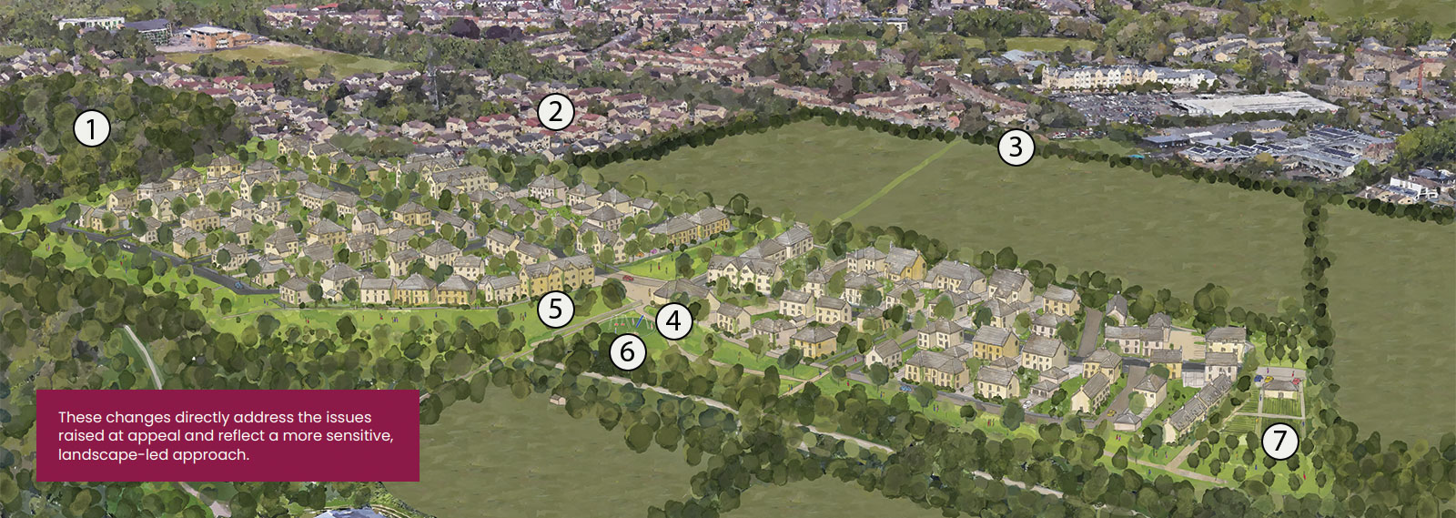
- 1Sulis Manor
- 2Sulis Meadows
- 3Wansdyke
- 4Community Building
- 5Public Green Space
- 6Play Area
- 7Allotments and community orchard
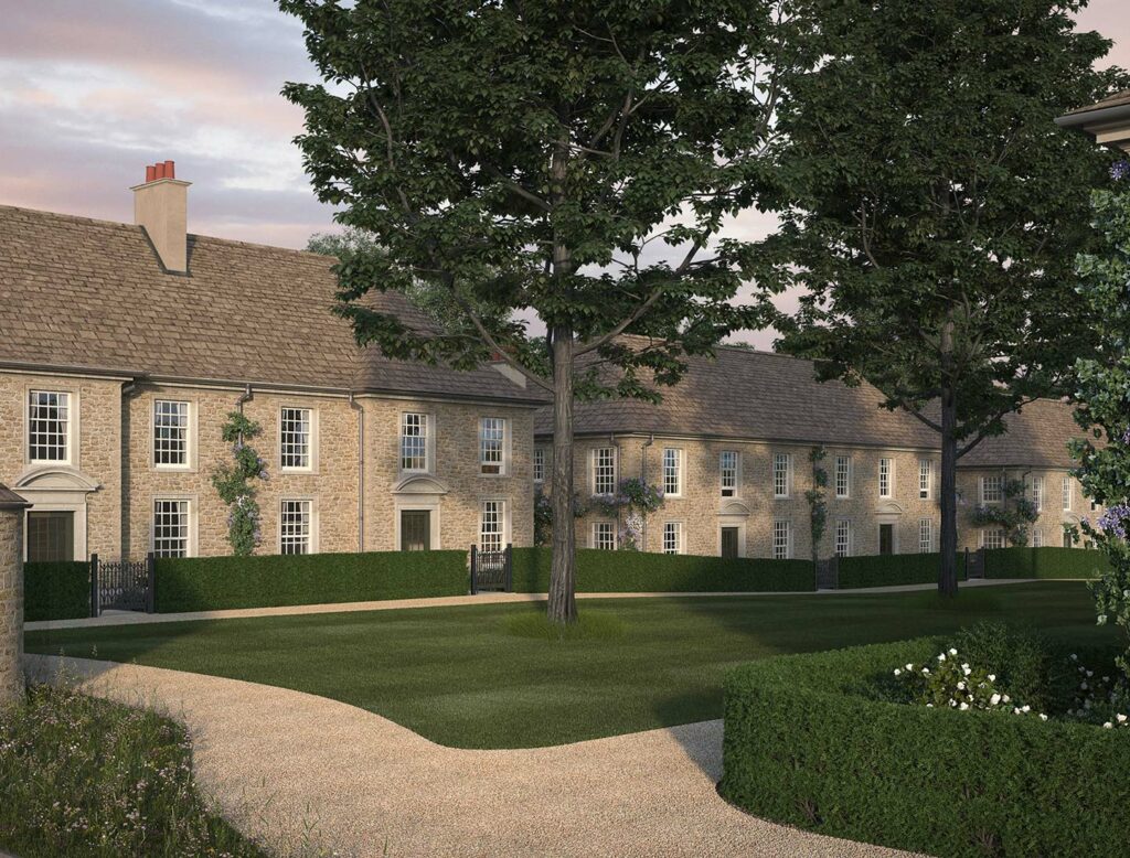
New homes
Homes designed with Bath in mind
Our ambition is to provide a carefully balanced mix of around 200 new homes that responds to the needs of Bath’s residents. This includes a range of sizes and tenures to support local families, key workers, younger people priced out of the city, and older residents looking for the right opportunity to downsize.
All homes will be designed to complement Bath’s character and heritage, taking inspiration from the city’s architectural traditions while ensuring energy efficiency and sustainability. Interiors will meet the expectations of modern living, combining comfort with low-carbon technologies.
By providing affordable homes alongside market housing, the plans will help ease local pressures, supporting those who would otherwise struggle to remain in Bath.

Community space
Bringing people together
We know that development must deliver more than just homes. A new community space is planned as part of our refreshed proposals, providing facilities that will benefit both new and existing Sulis Down residents.
Rather than making assumptions, we are inviting feedback on what type of space would be most valuable. This could mean a hall or pavilion for local groups, flexible rooms for events and activities, or outdoor areas that bring people together.
By co-designing this element with local communities, we aim to ensure the space has a clear purpose and a lasting legacy, strengthening the social fabric of the area.

Landscape and ecology
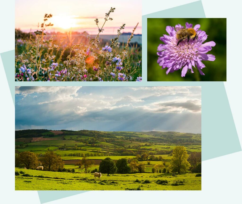
A sustainable, landscape-led development
Sulis Down sits on the Sulis Plateau, an elevated area on the southern edge of Bath. The site lies within the Cotswolds National Landscape and forms part of the setting of Bath’s World Heritage Site. Because of this location, changes to the landscape and skyline can be visible from a wide area and must be handled with great care.
The landscape strategy seeks to enhance biodiversity, create accessible green spaces and strengthen ecological networks across the site. Key elements include:
- Strengthening the southern woodland belt to reinforce the landscape edge and provide habitat for wildlife.
- New calcareous grassland, wildflower meadows and orchard planting.
- Restoration of dry-stone walls and enhancement of existing hedgerows.
- Creation of new habitats and ecological corridors that support biodiversity net gain.
- A central village green offering space for recreation, play and community activity.
- Allotments, pocket greens and a connected network of walking routes.
Connectivity
Sustainable and connected
Connectivity is central to the vision for Sulis Down. New and improved walking and cycling routes will link the site with Odd Down, local schools and Bath city centre, encouraging active travel and reducing reliance on cars. Enhancements to public transport, including more regular bus connections, will also support sustainable travel.
We are exploring how new infrastructure such as safe crossings and cycleways can connect Sulis Down to existing routes so that both current and future resident’s benefit.
In addition to transport improvements, contributions through Section 106 and the Community Infrastructure Levy will support investment in education, healthcare and other essential services. This will help ensure that new homes come alongside the facilities communities need.